Location
The island of La Gomera is situated south-west of Tenerife between Tenerife and El Hierro (closer to Tenerife – about 28 km). La Gomera is the island that you can see from the popular south Tenerife resorts like Los Cristianos, Playa de las Americas or Costa Adeje. You can get from Tenerife to La Gomera by ferry from Los Cristianos.
The coordinates of La Gomera are 28°06′ N 17°08′ W.
Surface and Landscape
In terms of surface area, La Gomera is the second smallest of the seven big islands. The smallest island is El Hierro, the five islands bigger than La Gomera are Tenerife, Fuerteventura, Gran Canaria, La Palma and Lanzarote.
The surface area of La Gomera is 369.76 km². The island has roughly round shape with diameter of approximately 22 km.
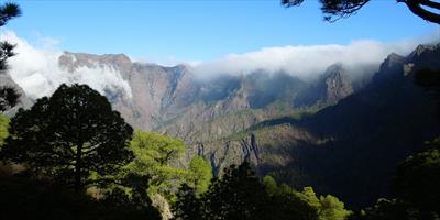
Like all other Canary Islands La Gomera has volcanic origin. The highest point is Garajonay (1,487 metres above sea level).
Population
Total population of La Gomera is 21,952 (as of 2006). From the administrative point of view, La Gomera belongs to the Tenerife province (the capital of this province is Santa Cruz de Tenerife).
There are six municipalities on La Gomera: Agulo, Alajero, San Sebastian de la Gomera, Hermigua, Valle Gran Rey, and Vallehermoso.
The biggest town, the capital of the island and the main port is San Sebastian de la Gomera, which is located on the east coast, facing south Tenerife. The population of San Sebastian is 8,451.